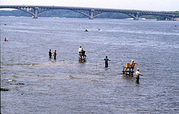
Bathing in the Dnipro River in Kyiv.
The Dnipro River (aka Dnieper) is the main river of Ukraine, and is usually considered the dividing line between the eastern (left bank of the river) and western (right bank of the river) Ukraine. The river originates in the Valdai Hills west of Moscow near Smolensk and then flows through Russia, Belarus and Ukraine before reaching the Black Sea; a total length of about 1,400 miles. Generally, it is a slow-moving river, liable to extensive spring flooding on its eastern bank.
Below Kyiv, there once were treacherous rapids (cataracts) and navigational barriers on the river in the vicinity of the present-day city of Zaporizhzhia (Запоріжжя). These rapids were a hindrance to navigation and trade on the river during the medieval period. When a dam was built on the Dnipro above Zaporizhzhia in 1932 (the Dnipro Hydroelectric Station), the rapids were submerged under the reservoir that formed. Just below Zaporizhzhia, there is a large island--Khortytsia Island is over ten miles long--which has been settled for thousands of years. Here the Zaporozhian Sich (Запорозька Січ) maintained the fortress capital of their cossack state in medieval and imperial Russia. These Ukrainian cossacks were a kind of irregular Russian frontier guards who served to defend Russia's southern frontier from the Turks to the south. The cossacks enjoyed many rights and privileges that other peasants did not; the cossacks were not fully subordinate to Russian authority until the nineteenth century.
![]()
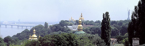
Kyiv with the Dnipro River in the background.
The Dnipro was known to both the Ancient Greeks and the Romans. In the Middle Ages, it was an important trade route between the Baltic Sea and Byzantium and the Black Sea. (See the Primary Chronicle Paragraph Assignment.) Kyiv, the capital of early medieval Rus', was located on the Dnipro. Most of the other important medieval Rus' towns such as Chernihiv, Pereiaslav and Smolensk, were also either on the Dnipro or one of its tributaries.
The last eight hundred kilometers of the river's length, before it empties into the Black Sea, is an almost consecutive chain of very large reservoirs which together form the "Dnipro Cascade of Hydroelectric Stations." These powerful hydroelectric generating stations, constructed by the Soviet regime beginning in the 1930s, provide about ten percent of Ukraine's electricity.
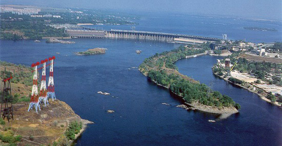
A dam on the Dnipro River near Zaporizhzhia.